St. Anton am Arlberg for Beginners
St. Anton am Arlberg scores 4.2/10 for beginners: Green and blue pistes (share of total km) 30.71 %, Nursery slope at village level 1 and Easy piste km starting near the base 7.9 km.
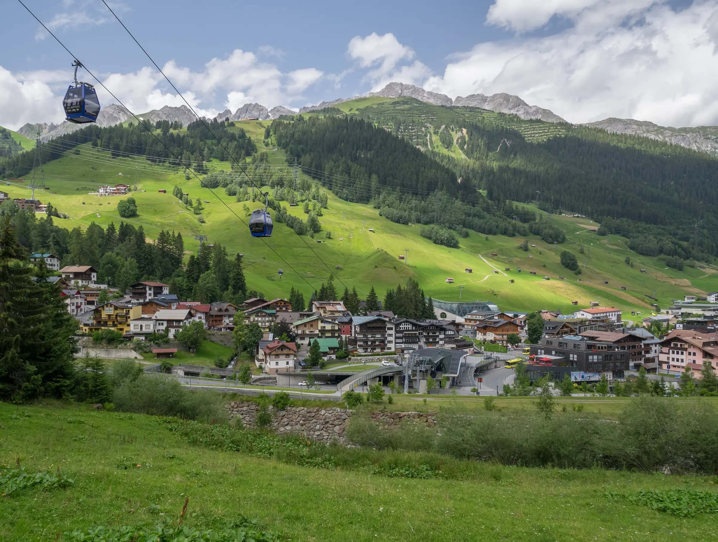
Photo: Basotxerri via Wikimedia Commons · CC BY-SA 4.0
- Piste network
- 159 km98.5 mi
- Lifts
- 38
- Top elevation
- 2,738 m8,980 ft
- Ski area
- Ski Arlberg
Beginner score
- 4.2Beginner
| Fact | Value |
|---|---|
| Green and blue pistes (share of total km) | 30.71 % |
| Nursery slope at village level | 1 |
| Easy piste km starting near the base | 7.9 km |
Facilities
| Fact | Value |
|---|---|
| Magic carpet lifts | 1 |
| Green runs | 0 |
| Ski schools | 0 |
Tips for beginners
- St. Anton am Arlberg scores 4.2/10 for beginners.
- 0% of the piste network is green, the easiest classification.
- 1 magic carpet lifts help first-timers get started.
- The village sits at 1284 m.
Green and blue runs
| Piste | Difficulty | Length | Vertical |
|---|---|---|---|
| Stallmähder-Fang | Blue | 4,261 m13,980 ft | 713 m2,340 ft |
| Valfagehr | Blue | 3,699 m12,140 ft | 705 m2,310 ft |
| Zammermoos - St. Anton | Blue | 3,006 m9,860 ft | 504 m1,650 ft |
| St. Christoph | Blue | 2,938 m9,640 ft | 435 m1,430 ft |
| Hoppelweg | Blue | 2,536 m8,320 ft | 440 m1,440 ft |
| Rauztobel | Blue | 2,298 m7,540 ft | 393 m1,290 ft |
| Steißbachtal | Blue | 2,155 m7,070 ft | 402 m1,320 ft |
| Fasch | Blue | 1,998 m6,560 ft | 462 m1,520 ft |
| Mittelstation - Rauz - Stuben | Blue | 1,865 m6,120 ft | 262 m860 ft |
| Riffel | Blue | 1,794 m5,890 ft | 432 m1,420 ft |
| Arlenmähder | Blue | 1,672 m5,490 ft | 304 m1,000 ft |
| Salzböden | Blue | 1,548 m5,080 ft | 367 m1,200 ft |
| 27 | Blue | 1,414 m4,640 ft | 229 m750 ft |
| Innere Schweinströge | Blue | 1,331 m4,370 ft | 256 m840 ft |
| Osthang Einfahrt | Blue | 1,303 m4,270 ft | 321 m1,050 ft |
| Skiweg Tanzböden | Blue | 1,293 m4,240 ft | 145 m480 ft |
| Maiensee | Blue | 1,256 m4,120 ft | 209 m690 ft |
| Ulmer Hütte | Blue | 1,228 m4,030 ft | 158 m520 ft |
| Riffelkar | Blue | 990 m3,250 ft | 261 m860 ft |
| Schwarze Wand | Blue | 988 m3,240 ft | 103 m340 ft |
| Seichböden | Blue | 893 m2,930 ft | 122 m400 ft |
| Mattunbahn zufahrt | Blue | 856 m2,810 ft | 101 m330 ft |
| Stock | Blue | 841 m2,760 ft | 127 m420 ft |
| Stallmähder - Fang | Blue | 555 m1,820 ft | 69 m230 ft |
| Tanzböden | Blue | 555 m1,820 ft | 125 m410 ft |
| Piste Nassereinlift | Blue | 550 m1,800 ft | 77 m250 ft |
| Piste Übungslift Gampen I + II | Blue | 445 m1,460 ft | 93 m310 ft |
| Steißbachtal Zufahrt | Blue | 387 m1,270 ft | 6 m20 ft |
| Übungswiese | Blue | 373 m1,220 ft | 110 m360 ft |
| Piste Muldenlift | Blue | 330 m1,080 ft | 46 m150 ft |
…and 7 more green/blue runs.
23 unnamed connecting sections, 2 km1.2 mi.
Frequently asked questions
Why does St. Anton am Arlberg score 4.2/10 for beginners?
The three inputs that move the score most are Green and blue pistes (share of total km) 30.71 %, Nursery slope at village level 1 and Easy piste km starting near the base 7.9 km.
Is there childcare in St. Anton am Arlberg?
3 childcare providers are listed in OpenStreetMap for St. Anton am Arlberg.
How many ski schools are there in St. Anton am Arlberg?
0.
How much of St. Anton am Arlberg is easy skiing?
30.7% of the piste km we measure is green or blue.
How high is the village in St. Anton am Arlberg?
1,284 m, with lifts to 2,738 m.
Are there magic carpets in St. Anton am Arlberg?
1 magic carpet are mapped in St. Anton am Arlberg.
How far is St. Anton am Arlberg from Innsbruck airport?
Innsbruck is about 85 minutes by road from St. Anton am Arlberg (83.2 km).
How high is St. Anton am Arlberg?
The highest lift-served point is 2,738 m, with the village at 1,284 m, a vertical of 1,450 m.
Related pages
Data updated · Sources: OpenStreetMap contributors (ODbL)