Davos Piste Map 2026/27
The official Davos piste map for 2026/27 is published by the resort (link below); every lift and run is listed here: 92.5 km of pistes (0 green, 23 blue, 17 red, 11 black) and 55 lifts.
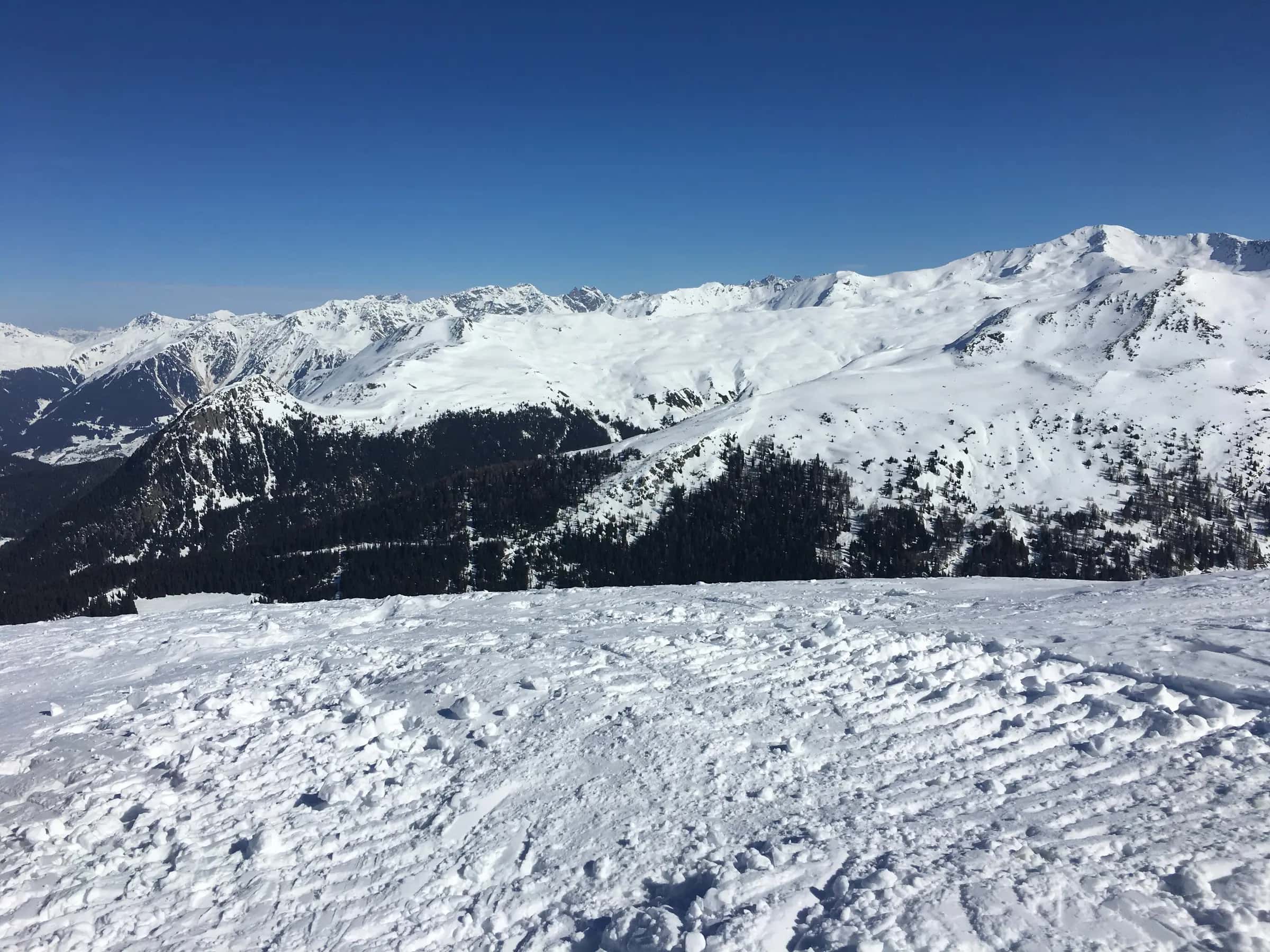
Photo: Jo-Jo Eumerus via Wikimedia Commons · CC BY-SA 4.0
Piste map
Lifts
| Lift | Type | Bottom → top | Length | Capacity/h |
|---|---|---|---|---|
| Bolgen | T-bar | 1,533 m5,030 ft → 1,594 m5,230 ft | 337 m1,110 ft | 1,100 |
| Bräma Jet | Chairlift | 1,911 m6,270 ft → 2,462 m8,080 ft | 1,413 m4,640 ft | 2,000 |
| Bünda | T-bar | 1,558 m5,110 ft → 1,698 m5,570 ft | 573 m1,880 ft | 1,200 |
| Carjöl - Carjöler Rank | Chairlift | 1,532 m5,030 ft → 1,597 m5,240 ft | 498 m1,630 ft | 1,200 |
| Carjöler Rank - Fuxägufer | Chairlift | 1,597 m5,240 ft → 2,120 m6,960 ft | 1,375 m4,510 ft | 1,200 |
| Clavadeler Bubble | Chairlift | 2,000 m6,560 ft → 2,473 m8,110 ft | 1,846 m6,060 ft | 2,800 |
| Furka Zipper | Chairlift | 2,063 m6,770 ft → 2,429 m7,970 ft | 1,559 m5,110 ft | 2,500 |
| Geissloch | T-bar | 1,533 m5,030 ft → 1,617 m5,310 ft | 301 m990 ft | 748 |
| Gipfelbahn | Cable car | 2,619 m8,590 ft → 2,797 m9,180 ft | 677 m2,220 ft | 1,100 |
| Güggel | Cable car | 2,473 m8,110 ft → 2,572 m8,440 ft | 242 m790 ft | 220 |
| Hauptertäli | T-bar | 2,449 m8,030 ft → 2,632 m8,640 ft | 1,049 m3,440 ft | 1,115 |
| Jakobshornbahn Sektion 1 | Cable car | 1,543 m5,060 ft → 1,911 m6,270 ft | 967 m3,170 ft | 1,250 |
| Jakobshornbahn Sektion 2 | Cable car | 1,906 m6,250 ft → 2,553 m8,380 ft | 1,987 m6,520 ft | 600 |
| Jatz Junior | T-bar | 2,397 m7,860 ft → 2,483 m8,150 ft | 386 m1,270 ft | 800 |
| Jatz Quattro | Chairlift | 2,090 m6,860 ft → 2,490 m8,170 ft | 1,229 m4,030 ft | 2,400 |
| Kreuzweg | T-bar | 2,328 m7,640 ft → 2,429 m7,970 ft | 356 m1,170 ft | 740 |
| Meierhofertäli | Chairlift | 2,233 m7,330 ft → 2,573 m8,440 ft | 1,577 m5,170 ft | 1,900 |
| Parsennbahn | Funicular | 1,589 m5,210 ft → 1,629 m5,340 ft | 226 m740 ft | 2,200 |
| Parsennbahn | Funicular | 2,229 m7,310 ft → 2,229 m7,310 ft | 23 m80 ft | 1,160 |
| Parsennbahn | Funicular | 1,736 m5,700 ft → 1,969 m6,460 ft | 488 m1,600 ft | 2,200 |
| Parsennbahn | Funicular | 1,629 m5,340 ft → 1,670 m5,480 ft | 122 m400 ft | 2,200 |
| Parsennbahn | Funicular | 1,985 m6,510 ft → 2,016 m6,610 ft | 69 m230 ft | 2,200 |
| Parsennbahn | Funicular | 1,969 m6,460 ft → 1,985 m6,510 ft | 60 m200 ft | 2,200 |
| Parsennbahn | Funicular | 2,475 m8,120 ft → 2,557 m8,390 ft | 435 m1,430 ft | 1,160 |
| Parsennbahn | Funicular | 2,430 m7,970 ft → 2,442 m8,010 ft | 92 m300 ft | 1,160 |
| Parsennbahn | Funicular | 2,453 m8,050 ft → 2,475 m8,120 ft | 110 m360 ft | 1,160 |
| Parsennbahn | Funicular | 2,016 m6,610 ft → 2,031 m6,660 ft | 10 m30 ft | 2,200 |
| Parsennbahn | Funicular | 2,031 m6,660 ft → 2,209 m7,250 ft | 477 m1,560 ft | 2,200 |
| Parsennbahn | Funicular | 1,985 m6,510 ft → 1,985 m6,510 ft | 7 m20 ft | 2,200 |
| Parsennbahn | Funicular | 2,651 m8,700 ft → 2,662 m8,730 ft | 80 m260 ft | 1,160 |
| Parsennbahn | Funicular | 1,736 m5,700 ft → 1,736 m5,700 ft | 38 m120 ft | 2,200 |
| Parsennbahn | Funicular | 1,670 m5,480 ft → 1,736 m5,700 ft | 232 m760 ft | 2,200 |
| Parsennbahn | Funicular | 1,836 m6,020 ft → 1,908 m6,260 ft | 161 m530 ft | 2,200 |
| Parsennbahn | Funicular | 2,229 m7,310 ft → 2,453 m8,050 ft | 1,162 m3,810 ft | 1,160 |
| Parsennbahn | Funicular | 2,209 m7,250 ft → 2,229 m7,310 ft | 40 m130 ft | 2,200 |
| Parsennbahn | Funicular | 2,557 m8,390 ft → 2,580 m8,460 ft | 103 m340 ft | 1,160 |
| Parsennbahn | Funicular | 2,580 m8,460 ft → 2,651 m8,700 ft | 240 m790 ft | 1,160 |
| Parsennhüttenbahn | Cable car | 2,207 m7,240 ft → 2,641 m8,660 ft | 2,349 m7,710 ft | 675 |
| Parsenn Rapid | Chairlift | 2,231 m7,320 ft → 2,662 m8,730 ft | 1,934 m6,350 ft | 2,600 |
| Pischabahn | Cable car | 1,810 m5,940 ft → 2,471 m8,110 ft | 1,892 m6,210 ft | 800 |
| Schatzalp-Bahn | Funicular | 1,582 m5,190 ft → 1,582 m5,190 ft | 23 m80 ft | 750 |
| Schatzalp-Bahn | Funicular | 1,582 m5,190 ft → 1,873 m6,150 ft | 609 m2,000 ft | 750 |
| Schatzalp-Bahn | Funicular | 1,710 m5,610 ft → 1,761 m5,780 ft | 86 m280 ft | 750 |
| Schatzalp-Bahn | Funicular | 1,873 m6,150 ft → 1,873 m6,150 ft | 15 m50 ft | 750 |
| Schatzalp-Strelaberg | Chairlift | 1,875 m6,150 ft → 2,132 m6,990 ft | 698 m2,290 ft | 700 |
| Schiferbahn 2 | Gondola | 2,002 m6,570 ft → 2,619 m8,590 ft | 3,537 m11,600 ft | 1,700 |
| Seetäli | T-bar | 2,151 m7,060 ft → 2,416 m7,930 ft | 1,130 m3,710 ft | 1,100 |
| Strelaberg-Strelapass | T-bar | 2,117 m6,950 ft → 2,353 m7,720 ft | 1,233 m4,050 ft | 700 |
| Totalp | Chairlift | 2,201 m7,220 ft → 2,641 m8,660 ft | 2,239 m7,350 ft | 2,400 |
| Usser Isch-Express | Chairlift | 2,055 m6,740 ft → 2,356 m7,730 ft | 906 m2,970 ft | 2,400 |
| Wakeboard-Lift Davos | Drag lift | 1,558 m5,110 ft → 1,561 m5,120 ft | 177 m580 ft | - |
| Goods lift | Goods lift | 1,655 m5,430 ft → 1,952 m6,400 ft | 681 m2,230 ft | - |
| Goods lift | Goods lift | 1,760 m5,770 ft → 2,178 m7,150 ft | 800 m2,620 ft | - |
| Rope tow | Rope tow | 2,338 m7,670 ft → 2,348 m7,700 ft | 115 m380 ft | - |
| Drag lift | Drag lift | 1,900 m6,230 ft → 1,941 m6,370 ft | 78 m260 ft | - |
| Drag lift | Drag lift | 1,900 m6,230 ft → 1,900 m6,230 ft | 40 m130 ft | - |
| Drag lift | Drag lift | 1,889 m6,200 ft → 1,900 m6,230 ft | 28 m90 ft | - |
Pistes
Blue (23)
| Piste | Difficulty | Length | Vertical | Top elevation |
|---|---|---|---|---|
| Jakobshorn Standard | Blue | 3,135 m10,290 ft | 632 m2,070 ft | 2,503 m8,210 ft |
| 3 | Blue | 3,067 m10,060 ft | 312 m1,020 ft | 1,873 m6,150 ft |
| Traverse | Blue | 2,990 m9,810 ft | 568 m1,860 ft | 2,462 m8,080 ft |
| Bobbahnstrasse | Blue | 2,879 m9,450 ft | 283 m930 ft | 1,889 m6,200 ft |
| Weissfluhjoch - Parsennhütte | Blue | 2,656 m8,710 ft | 415 m1,360 ft | 2,623 m8,610 ft |
| Skischul Run | Blue | 2,271 m7,450 ft | 433 m1,420 ft | 2,662 m8,730 ft |
| Clavadeler Piste | Blue | 2,201 m7,220 ft | 429 m1,410 ft | 2,301 m7,550 ft |
| Gämpen - Davos | Blue | 1,822 m5,980 ft | 333 m1,090 ft | 1,994 m6,540 ft |
| Meierhofertäli | Blue | 1,805 m5,920 ft | 349 m1,150 ft | 2,545 m8,350 ft |
| Gämpeweg | Blue | 1,782 m5,850 ft | 126 m410 ft | 1,732 m5,680 ft |
| Boardercross | Blue | 1,267 m4,160 ft | 242 m790 ft | 2,466 m8,090 ft |
| Hauptertäli | Blue | 1,259 m4,130 ft | 183 m600 ft | 2,614 m8,580 ft |
| Parsennhütte - Gruobenalp | Blue | 1,160 m3,810 ft | 135 m440 ft | 2,208 m7,240 ft |
| Dorftäli | Blue | 1,131 m3,710 ft | 207 m680 ft | 2,488 m8,160 ft |
| Jakobshorn | Blue | 659 m2,160 ft | 50 m160 ft | 2,553 m8,380 ft |
| 1 | Blue | 613 m2,010 ft | 57 m190 ft | 2,353 m7,720 ft |
| Ischalp | Blue | 441 m1,450 ft | 63 m210 ft | 2,039 m6,690 ft |
| Waldabfahrt | Blue | 409 m1,340 ft | 121 m400 ft | 1,931 m6,340 ft |
| Clavadeleralpstrasse | Blue | 369 m1,210 ft | 47 m150 ft | 2,036 m6,680 ft |
| Bräma (rot) | Blue | 349 m1,150 ft | 37 m120 ft | 2,362 m7,750 ft |
| Rennstrecke | Blue | 324 m1,060 ft | 55 m180 ft | 1,613 m5,290 ft |
| Talabfahrt Gämpen | Blue | 59 m190 ft | 14 m50 ft | 2,008 m6,590 ft |
| Kinderland Schweizerische Schneesportschule Davos | Blue | - | - | 1,533 m5,030 ft |
Red (15)
| Piste | Difficulty | Length | Vertical | Top elevation |
|---|---|---|---|---|
| Usser Isch | Red | 2,052 m6,730 ft | 647 m2,120 ft | 2,356 m7,730 ft |
| Standard - Höhenweg | Red | 1,995 m6,550 ft | 431 m1,410 ft | 2,662 m8,730 ft |
| Weissfluhjoch - Kreuzweg | Red | 1,882 m6,170 ft | 287 m940 ft | 2,623 m8,610 ft |
| 4 | Red | 1,790 m5,870 ft | 351 m1,150 ft | 2,231 m7,320 ft |
| Bräma (schwarz/rot) | Red | 1,411 m4,630 ft | 374 m1,230 ft | 2,305 m7,560 ft |
| Seetäli | Red | 1,296 m4,250 ft | 287 m940 ft | 2,438 m8,000 ft |
| Bräma (rot) | Red | 1,179 m3,870 ft | 349 m1,150 ft | 2,325 m7,630 ft |
| Jatzpiste | Red | 1,155 m3,790 ft | 338 m1,110 ft | 2,428 m7,970 ft |
| Furka Links | Red | 1,114 m3,650 ft | 253 m830 ft | 2,432 m7,980 ft |
| Furka Rechts | Red | 910 m2,990 ft | 217 m710 ft | 2,429 m7,970 ft |
| Furka - Kreuzweg | Red | 436 m1,430 ft | 98 m320 ft | 2,429 m7,970 ft |
| Speed-Strecke | Red | 332 m1,090 ft | 75 m250 ft | 2,356 m7,730 ft |
| Bünda Buckelpiste | Red | 254 m830 ft | 45 m150 ft | 1,603 m5,260 ft |
| 3 | Red | 180 m590 ft | 58 m190 ft | 2,349 m7,710 ft |
| 18 | Red | 55 m180 ft | 22 m70 ft | 2,429 m7,970 ft |
Black (11)
| Piste | Difficulty | Length | Vertical | Top elevation |
|---|---|---|---|---|
| Gruobenalp - Wolfgang | Black | 3,304 m10,840 ft | 418 m1,370 ft | 2,063 m6,770 ft |
| Meierhof - Wolfgang | Black | 2,319 m7,610 ft | 588 m1,930 ft | 2,233 m7,330 ft |
| Gipfel Nord - Kreuzweg | Black | 2,173 m7,130 ft | 467 m1,530 ft | 2,820 m9,250 ft |
| Höhenweg - Davos 2 | Black | 1,786 m5,860 ft | 438 m1,440 ft | 2,031 m6,660 ft |
| Davos Vertical | Black | 987 m3,240 ft | 410 m1,350 ft | 2,037 m6,680 ft |
| Gipfel Ost - Wasserscheide | Black | 879 m2,880 ft | 199 m650 ft | 2,797 m9,180 ft |
| Höhenweg - Davos | Black | 520 m1,710 ft | 213 m700 ft | 2,229 m7,310 ft |
| Bräma (schwarz/rot) | Black | 429 m1,410 ft | 170 m560 ft | 2,475 m8,120 ft |
| Jakobshorn Nord | Black | 423 m1,390 ft | 134 m440 ft | 2,496 m8,190 ft |
| Usser Isch | Black | 292 m960 ft | 122 m400 ft | 2,358 m7,740 ft |
| 7 | Black | 23 m80 ft | 15 m50 ft | 2,031 m6,660 ft |
Freeride (23)
| Piste | Difficulty | Length | Vertical | Top elevation |
|---|---|---|---|---|
| Flüelameder | Freeride | 3,324 m10,910 ft | 673 m2,210 ft | 2,483 m8,150 ft |
| Dischmatal Warm-Up | Unclassified | 3,184 m10,450 ft | 44 m140 ft | 1,593 m5,230 ft |
| Dischma Uphill | Unclassified | 3,155 m10,350 ft | 115 m380 ft | 1,704 m5,590 ft |
| Müli | Freeride | 3,038 m9,970 ft | 839 m2,750 ft | 2,482 m8,140 ft |
| Teufi | Freeride | 2,880 m9,450 ft | 871 m2,860 ft | 2,572 m8,440 ft |
| City-Trail Davos | Unclassified | 2,694 m8,840 ft | 35 m110 ft | 1,575 m5,170 ft |
| Nachtloipe | Unclassified | 2,251 m7,390 ft | 46 m150 ft | 1,569 m5,150 ft |
| Junkerboden-Runde (Nr. 17) | Unclassified | 2,123 m6,970 ft | 34 m110 ft | 1,547 m5,080 ft |
| Herz-Loipe Davos | Unclassified | 1,528 m5,010 ft | 12 m40 ft | 1,542 m5,060 ft |
| 8 | Freeride | 1,353 m4,440 ft | 348 m1,140 ft | 2,797 m9,180 ft |
| Dischmatal Uphill vorne | Unclassified | 1,268 m4,160 ft | 23 m80 ft | 1,594 m5,230 ft |
| City-Trail Davos | Unclassified | 1,036 m3,400 ft | 1 m0 ft | 1,555 m5,100 ft |
| Sertig Classic | Unclassified | 1,017 m3,340 ft | 51 m170 ft | 1,668 m5,470 ft |
| Äbiwaldweg | Unclassified | 791 m2,600 ft | 35 m110 ft | 1,647 m5,400 ft |
| Witibärgweg | Freeride | 636 m2,090 ft | 21 m70 ft | 2,503 m8,210 ft |
| Heidbodaweg | Unclassified | 480 m1,570 ft | 18 m60 ft | 1,565 m5,130 ft |
| Meierhof (Abfahrt - Freeride) | Freeride | 456 m1,500 ft | 151 m500 ft | 2,641 m8,660 ft |
| Usser Isch | Freeride | 345 m1,130 ft | 138 m450 ft | 2,496 m8,190 ft |
| Schwarzseealpstrasse | Unclassified | 264 m870 ft | 17 m60 ft | 1,653 m5,420 ft |
| Funpark | Unclassified | 218 m720 ft | 41 m130 ft | 1,600 m5,250 ft |
| Hügelpiste | Unclassified | 200 m660 ft | 6 m20 ft | 1,555 m5,100 ft |
| Halfpipe | Unclassified | 120 m390 ft | 10 m30 ft | 1,544 m5,070 ft |
| 13 | Freeride | 66 m220 ft | 0 m0 ft | 2,503 m8,210 ft |
177 unnamed connecting sections, 46 km28.5 mi.
Ski area map
Frequently asked questions
How many runs of each colour does Davos have?
0 green, 23 blue, 17 red and 11 black, 59 in total.
What is the longest run in Davos?
The longest single marked run we measure is 3.3 km.
What are the hardest runs in Davos?
The black runs we hold names for include Gruobenalp - Wolfgang, Meierhof - Wolfgang, Gipfel Nord - Kreuzweg, Höhenweg - Davos 2 and Davos Vertical.
Where can I download the Davos piste map?
The resort publishes the current map itself; the link on this page goes straight to it, and the lift and piste tables below are generated from OpenStreetMap.
What kinds of lift does Davos have?
1 gondola or cable car, 11 chairlifts, 13 drag lifts and 0 magic carpets.
How far is Davos from Bodensee Friedrichshafen airport?
Bodensee Friedrichshafen is about 136 minutes by road from Davos (99 km).
How high is Davos?
The highest lift-served point is 2,797 m, with the village at 1,556 m, a vertical of 1,264 m.
How many km of pistes does Davos have?
Davos has 92.5 km of marked pistes across 59 runs, measured from OpenStreetMap geometry.
Related pages
Data updated · Sources: OpenStreetMap contributors (ODbL)