Val Thorens for Families
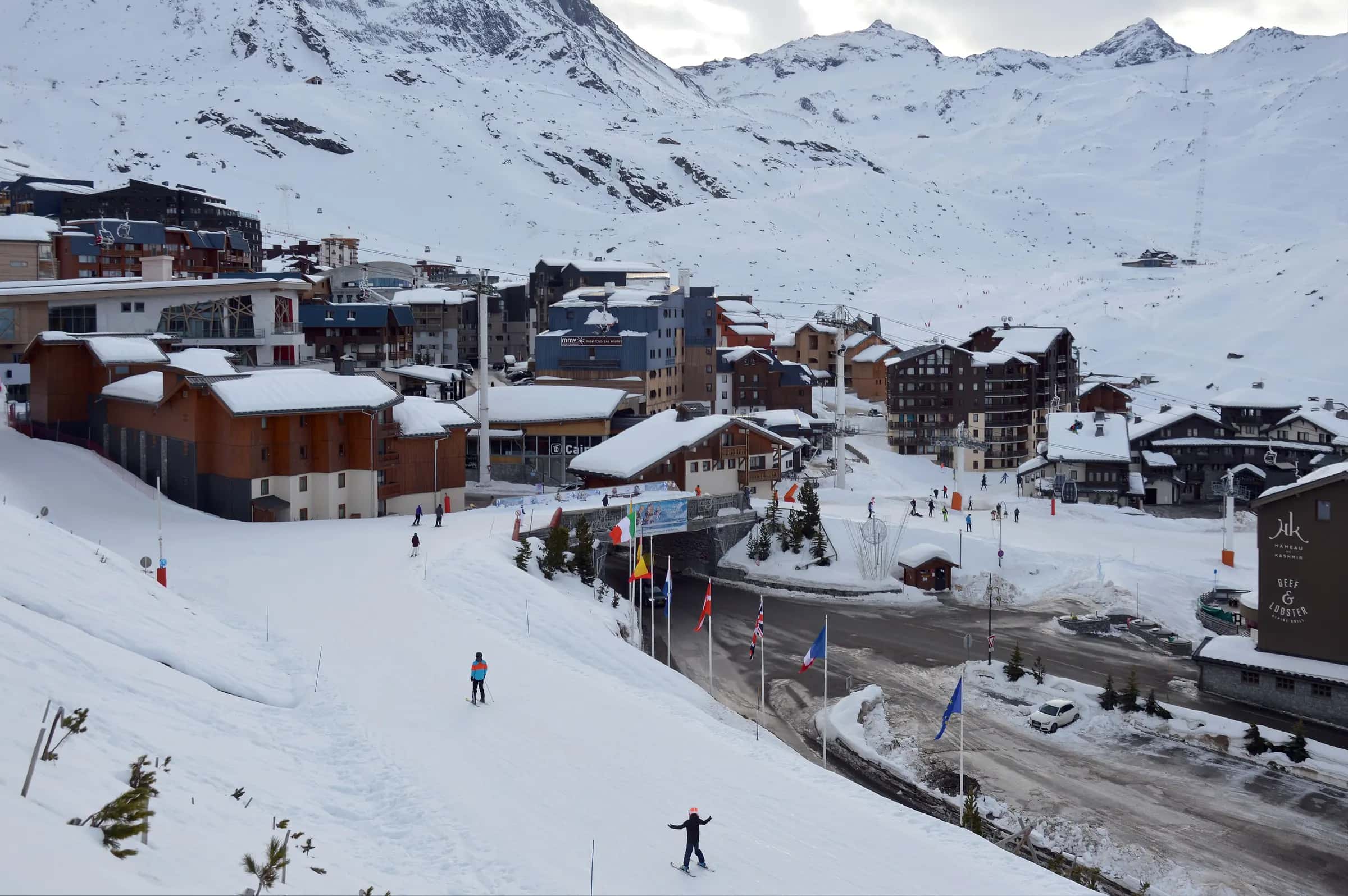
Val Thorens scores 4.5/10 for families: Beginner score 6.7 /10, Village elevation 1,710 m and Pool, ice rink or cinema 2 of 3.
- Piste network
- 160 km99.4 mi
- Lifts
- 36
- Top elevation
- 3,211 m10,530 ft
- Ski area
- Les 3 Vallées
Family score
- 4.5Family
| Fact | Value |
|---|---|
| Beginner score | 6.7 /10 |
| Village elevation | 1,710 m |
| Pool, ice rink or cinema | 2 of 3 |
Facilities
| Fact | Value |
|---|---|
| Childcare facilities | 0 |
| Pools | 2 |
| Ski schools | 1 |
Tips for families
- Val Thorens scores 4.5/10 for families.
- 54% of the piste network is green or blue, the easiest classification.
- The village sits at 1710 m.
Easy pistes
| Piste | Difficulty | Length | Vertical |
|---|---|---|---|
| Lac de la Chambre | Blue | 4,227 m13,870 ft | 664 m2,180 ft |
| Lory | Blue | 3,510 m11,520 ft | 475 m1,560 ft |
| Blanchot | Blue | 3,077 m10,100 ft | 609 m2,000 ft |
| Mont de la Chambre | Blue | 2,961 m9,710 ft | 602 m1,980 ft |
| La croix d'Antide | Green | 2,744 m9,000 ft | 417 m1,370 ft |
| Peyron | Blue | 2,692 m8,830 ft | 443 m1,450 ft |
| Tétras | Blue | 2,676 m8,780 ft | 654 m2,150 ft |
| Tête Ronde | Blue | 2,597 m8,520 ft | 433 m1,420 ft |
| Gentianes | Blue | 2,477 m8,130 ft | 460 m1,510 ft |
| Génépi | Blue | 2,470 m8,100 ft | 441 m1,450 ft |
| Pluviomètre | Blue | 2,470 m8,100 ft | 482 m1,580 ft |
| Fond | Blue | 2,156 m7,070 ft | 384 m1,260 ft |
| Moraine | Blue | 2,062 m6,770 ft | 396 m1,300 ft |
| Combe de Thorens | Green | 1,953 m6,410 ft | 189 m620 ft |
| Gentiane | Green | 1,708 m5,600 ft | 261 m860 ft |
| Hermine | Blue | 1,604 m5,260 ft | 340 m1,120 ft |
| Plein Sud | Blue | 1,590 m5,220 ft | 299 m980 ft |
| Boulevard Cumin | Blue | 1,417 m4,650 ft | 182 m600 ft |
| Niverolles | Blue | 1,403 m4,600 ft | 220 m720 ft |
| Chalets | Blue | 1,349 m4,430 ft | 238 m780 ft |
| Dalles | Blue | 1,331 m4,370 ft | 267 m880 ft |
| Face Nord | Blue | 1,329 m4,360 ft | 292 m960 ft |
| Boulevard du Téléphérique | Blue | 1,222 m4,010 ft | 129 m420 ft |
| Chocard | Blue | 1,219 m4,000 ft | 258 m850 ft |
| Plan du Bouquet | Blue | 1,147 m3,760 ft | 258 m850 ft |
| Espace Junior | Green | 1,039 m3,410 ft | 133 m440 ft |
| Chamois | Blue | 1,025 m3,360 ft | 224 m730 ft |
| Boulevard des Echauds | Blue | 979 m3,210 ft | 111 m360 ft |
| Fun Slope | Blue | 918 m3,010 ft | 80 m260 ft |
| Plateau | Blue | 892 m2,930 ft | 161 m530 ft |
…and 32 more green/blue runs.
102 unnamed connecting sections, 16 km9.8 mi.
Frequently asked questions
Why does Val Thorens score 4.5/10 for families?
The three inputs that move the score most are Beginner score 6.7 /10, Village elevation 1,710 m and Pool, ice rink or cinema 2 of 3.
Is there childcare in Val Thorens?
0 childcare providers are listed in OpenStreetMap for Val Thorens.
How many ski schools are there in Val Thorens?
1.
How much of Val Thorens is easy skiing?
53.5% of the piste km we measure is green or blue.
How high is the village in Val Thorens?
1,710 m, with lifts to 3,211 m.
Are there magic carpets in Val Thorens?
6 magic carpets are mapped in Val Thorens.
How far is Val Thorens from Chambéry Aix les Bains airport?
Chambéry Aix les Bains is about 101 minutes by road from Val Thorens (66.5 km).
How high is Val Thorens?
The highest lift-served point is 3,211 m, with the village at 1,710 m, a vertical of 2,314 m.
Related pages
Data updated · Sources: OpenStreetMap contributors (ODbL)